

Oshakati Flood Protection
In recent years, heavy floods occurred in the Oshana region in central northern Namibia. The town of Oshakati, the regional capital, was severely affected by these floods as well. At other times, however, there are water shortages. Therefore, the Namibian Government, together with the Oshakati Town Council, commissioned the design of a plan to make Oshakati flooding free, incorporated in the Oshakati Master Plan.
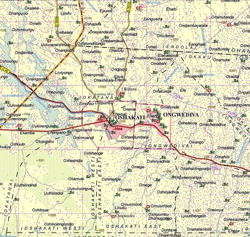
Heavy floods in March 2008, February 2009 and April 2011 caused economic damage, closing of roads, inaccessibility to services (schools, hospitals etc.) and even loss of life in the town of Oshakati, an important commercial, industrial and administrative centre.
The floods affecting Oshakati are the result of heavy rainfall in the catchment, most of which is situated on Angolan territory, causing water to flow through the oshanas (shallow, seasonally inundated depressions) all the way through the river. Oshanas are ephemeral by nature, hence they only transport water during the rainy season; outside the rainy season, the oshanas are dry. They are not very deep (about 1-2 m), but can be very wide (several hundreds of meters).
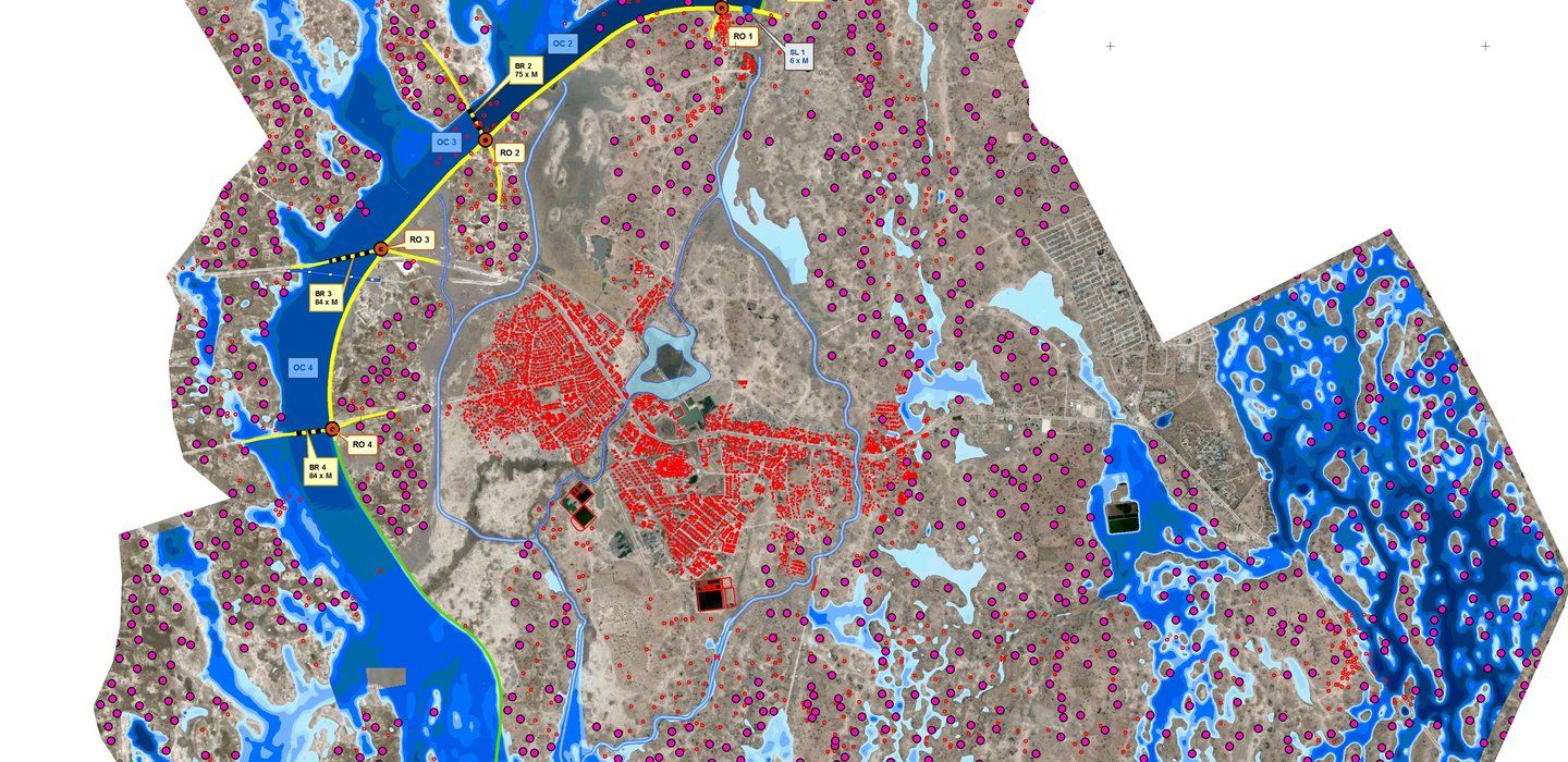
To make Oshakati flooding free, a dike will be constructed, extending from the north of Okatana to the west of Oshakati, diverting the main flows conveyed by the oshanas.
IMDC was assigned by BAR Namibia, the consultancy bureau developing the Oshakati Master Plan to design, tender and supervise the flood protection measures.
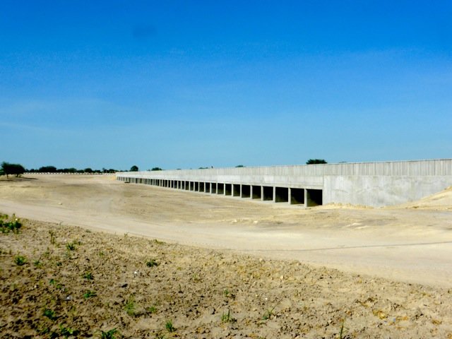
The main components of IMDC’s scope were hydrodynamic modelling, design of the dike and all related structures, such as side drainage ditches, culvert bridges, a drinking water siphon underneath the dike, and a sluice that enables water to flow through Oshakati if desired. Also, possible changes in the morphological behaviour, due to the changes in how the water flows around the town, were investigated. Moreover, IMDC was responsible for the supervision of the geotechnical and road design with the related cost calculations, and the interaction with the Environmental Impact Assessment (EIA) team.
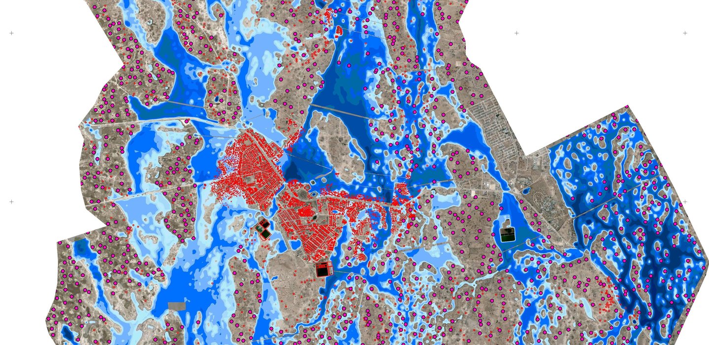
To study the impact of the construction of the dike on the floods in the area, and to give input to the hydraulic design of the above mentioned structures, a quasi-2D hydrodynamic model was built. With the model it was possible to compare flood maps of the current situation with the situation were the dike protects the town. As a result of the flood protection measures a total area of 50 km² will be flooding free and available for the future development of the town of Oshakati.
Data
- Client: BAR Namibia
- Start date: 2011
- Completion date: 2013

