OMES - Research on the environment effects of the Sigmaplan
The Flemish Waterways started in 1995 with an extensive monitoring and research program to evaluate effects on the environment and ecosystems from major operations on the rivers Sea Scheldt and Rupel (Belgium). This Monitoring and Research Program (OMES in short) consists of several parts which are executed by different research teams with international scientists. At least every month, several environmental parameters are sampled on 21 fixed stations spread along the Sea Scheldt and Rupel. Additional every year through-tide measurement campaigns are executed. Within this monitoring program IMDC is responsible – since 2011 – for data collection of suspended particulate matter (SPM) and currents.
Since 1995, a Monitoring and Research Program was launched to evaluate effects of major activities on the environment of the river Sea Scheldt. This program, referred as OMES, allows you to gain insight to assess effects of future developments. In 2009 the program was extended with the river Rupel.
The monitoring program contains 6 different parts to determine following aspects on the rivers Sea Scheldt and Rupel:
- Basic water quality
- Carbon cycle and suspended particulate matter (SPM)
- Phytoplankton and phytobenthos
- Primary production
- Zooplankton
An additional part is to investigate the effect of water quality and tide on flood control areas (FCA's), for example in the pilot project Lippenbroek in Hamme (Flanders). Lippenbroek is a flood control areas with reduced tides. It is part of the Sigmaplan.
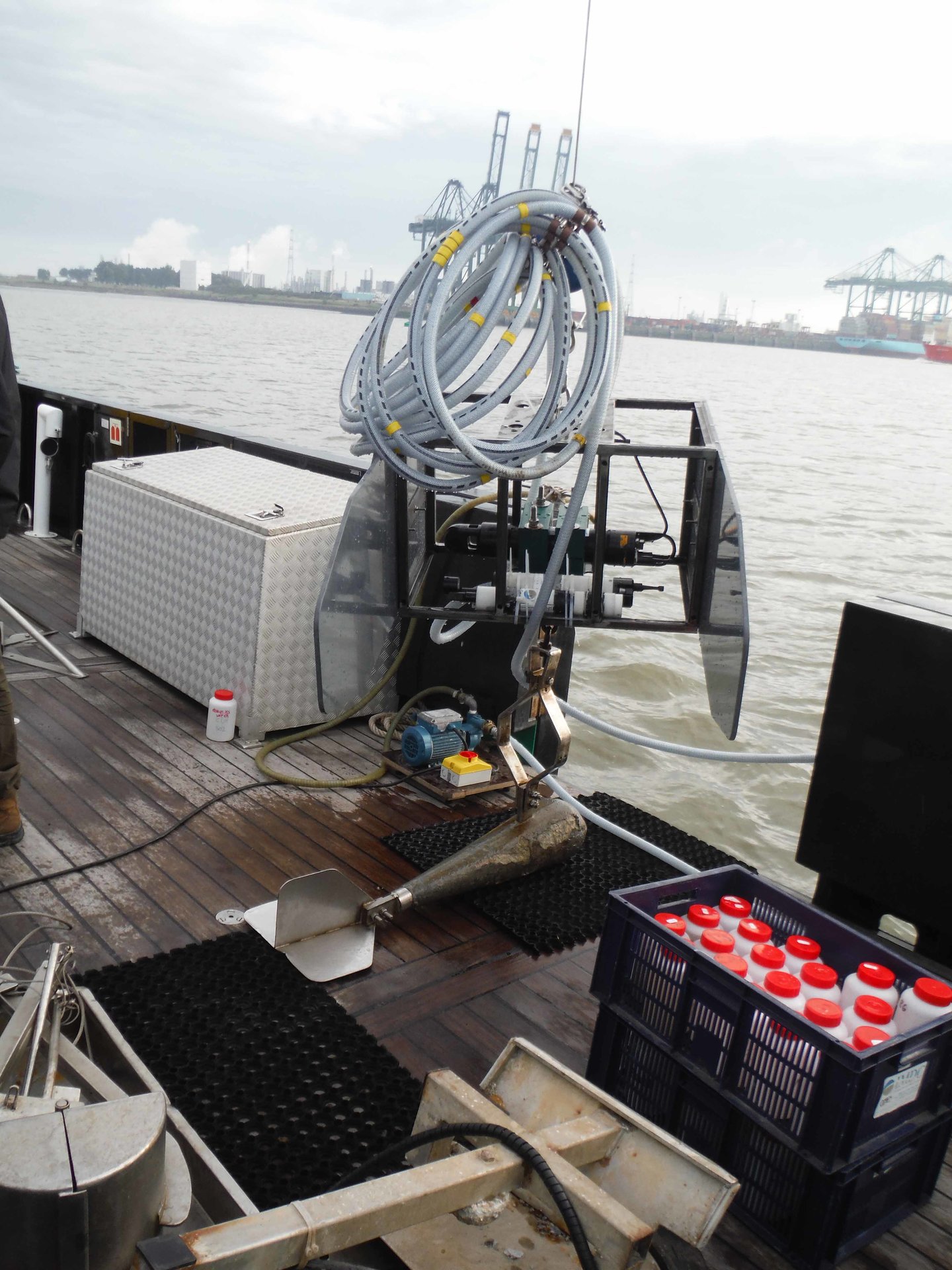
Each part is carried out by different research teams with international scientists. Since 2010, IMDC is responsible for SPM behaviour within this monitoring program on the rivers Sea Scheldt, Rupel and the FCA Lippenbroek. The monitoring is conducted annually in a systematic way consisting of through tide measurements and monthly campaigns. Through tide measurement campaigns are performed to determine the behaviour of SPM and currents during tidal cycle at 4 predefined sites at Kruibeke, Schoonaarde, CFA Lippenbroek and Terhagen. To monitor the long-term effects in the rivers Sea Scheldt and Rupel, one or two survey campaigns per month are organized over 20 predefined sample locations along both rivers. At these locations profiles are taken from SPM and currents. The campaign is spread over three survey days. To perform the monitoring program, we use the following instruments:
- Acoustic Doppler
- Current Profilers (ADCP)
- Salinity meters (type CTD)
- Turbidity meters (type OBS)
- Water samplers
The ADCP backscatter intensities are also converted to SPM using the software SEDIVIEW and water samples, based on salinity and turbidity profiles.
For more information on OMES and the Sigmaplan, please visit https://www.omes-monitoring.be/en and www.sigmaplan.be/en

Data
- Client: De Vlaamse Waterweg nv
- Start date: 2011
- Completion date: 2021

