

Rio Guayas Estuary: Numerical Modelling of Hydrodynamics and Sediment Transport
A numerical modelling study has been executed using TELEMAC modelling suite with aim to assess the sediment dynamics in Rio Guayas estuary and navigation channel to the port of Guayaquil.
 After a phase of data collection, consisting of historical data and an in-situ measurement campaign organised by IMDC modelling team, numerical models have been developed to capture the tidal and wave characteristics in the bay and to simulate the sand and fine sediment transport in the estuary and navigation channel to the port of Guayaquil. The monitoring data set consisting of water level, flow velocity profiles, sediment concentration profiles and waves is extensively used for model calibration. It was shown the model reached a high degree of accuracy for hydrodynamics and sediment transport, and can be used for studying sediment dynamics in the estuary.
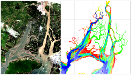
 Model domain extent upstream area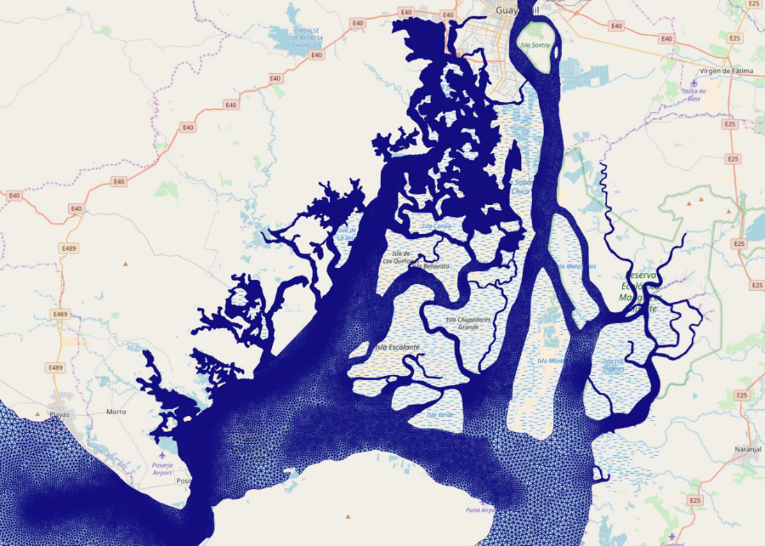
Characteristic example of the measured and model velocity magnitude and direction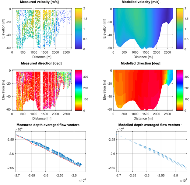
Modelled and measured sediment (using the SitProfiler) concentration profiles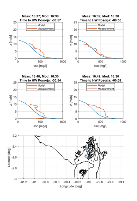
Data
- Start date: 2018
- Completion date: 2018