
Decision support for flood risk management plans
The project interprets the European Floods Directive (2007/60/EG) for the Flemish non-navigable watercourses. In order to comply with the Directive member states had to prepare flood hazard maps, flood risk maps and flood risk management plans. IMDC developed a full probabilistic approach and applied this to 47 catchments of non-navigable watercourses in the Flanders Region of Belgium.
According to the Directive flood risk management plans should focus on preparedness, prevention and protection, considering climate change and land use change impacts. IMDC developed a full probabilistic approach and applied this to 47 hydrologic and hydrodynamic modelled catchments (InfoWorks RS software) of non-navigable watercourses in the Flanders Region of Belgium.
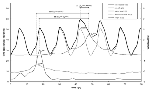
The storm generator allows for the generation of a set of synthetic events with corresponding probabilities of occurrence, based on time series of rainfall runoff. The rainfall runoff time series result from the hydrologic simulation of time series of rainfall and evaporation. These time series are perturbated to take the impact of climate change into account.
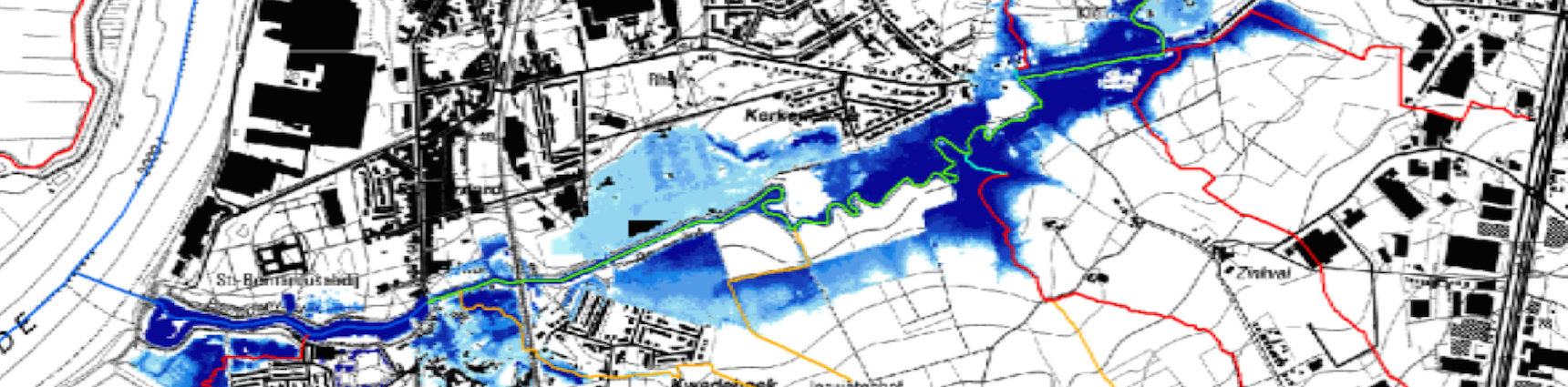
The synthetic events pass through a model chain containing a hydrodynamic model and an impact model. Hydrodynamic simulation yields in flood hazard maps for a number of return periods. The impact model translates the hazard maps in risk maps. The impact model also includes land use change.
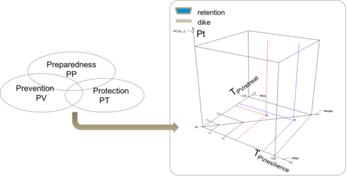
The scenario generator allows to define and assess all possible combinations of measures to decrease flood risk. The combinations are presented as a cube. The vertical axis represents the protective measures, e.g. retention zones and dikes. The horizontal axes represent the preventive measures, e.g. renovation and construction of buildings with flood resilient measures and a building prohibition. Preventive measures are implemented within flood contours with various return periods. Preparedness measures add a fourth dimension to the cube. They include the development and maintenance of a flood forecasting system, the production and distribution of sandbags and awareness campaigns.
Protective measures affect the probability of flooding, while preventive and preparedness measures affect the adverse consequences of flooding.
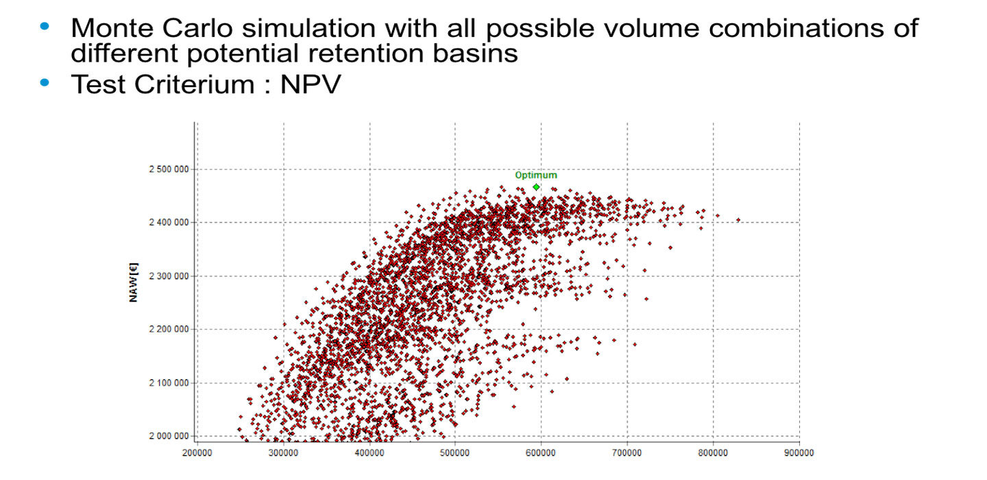
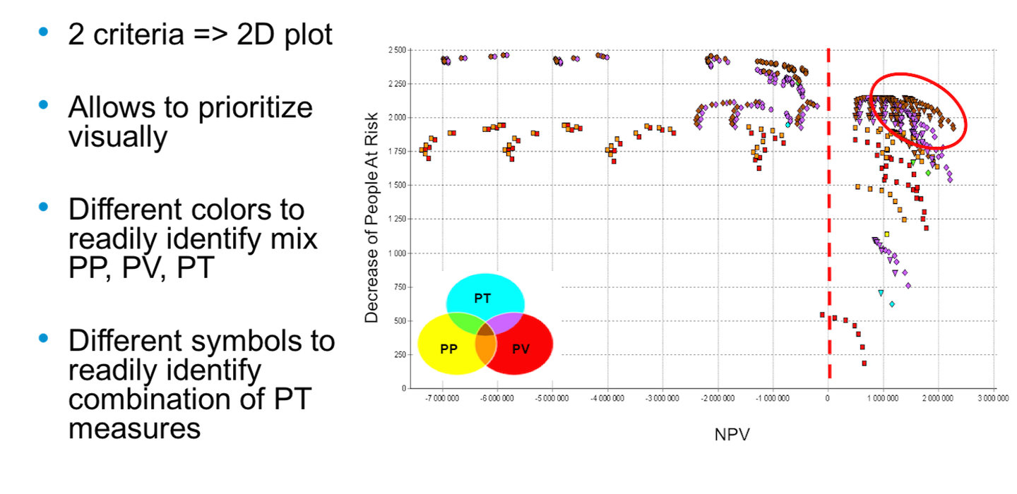
All combinations of measures are run through the model chain and assessed against a cost benefit criterion (net present value, NPV) and a social criterion (decrease of people at risk). The approach enables decision makers in the process of selection options for flood risk management plans.
The above approach is applied to 47 hydrologic and hydraulic modelled non-navigable watercourses in the Flemish Region. The catchments are located in the 5 jurisdictions of the Flemish Environment Agency (East Flanders, West Flanders, Flemish Brabant, Antwerp and Limburg). The total length of modelled watercourse is 1438 km. The total area of modelled catchment is 7857 km².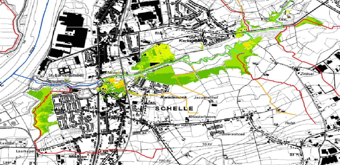
Data
- Client: Vlaamse Milieumaatschappij
- Start date: 2009
- Completion date: 2013


